Maqams in the West Bank Album
- « first
- ‹ previous
- 1
- 2
- 3
Photographer:
Apr-22-2019
Apr-22-2019

Photographer:
Apr-22-2019
Apr-22-2019

Photographer:
Apr-22-2019
Apr-22-2019
Photographer:
Apr-22-2019
Apr-22-2019
Photographer:
Apr-15-2019
Apr-15-2019

Photographer:
Apr-12-2019
Apr-12-2019
Photographer:
Mar-25-2019
Mar-25-2019
Photographer:
Feb-6-2017
Feb-6-2017

Photographer: Irit Segoli
Feb-11-2019
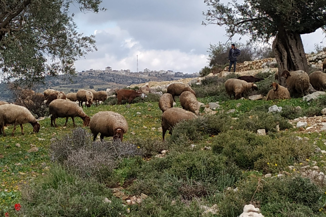
להלן, מידע מטעה שכזה הוא אופייני ומופיע במפת עמוד ענן, בכל אתר ואתר. יש לו תרומה לרוח הקרב של המתנחלים והאמונה שלהם שהם פועלים בשם החוק והמוסלמים הם מפרי החוק. לכן התערבות בתכני המיזם הזה חשובה ביותר. הסקר שערכנו מכיל כמויות עצומות של אינפורמציה עובדתית. ח'רבת נעלן נ.צ. 651976 / 214304 גובה: 633 חורבת נעלן היא חורבה מבית שני וכנראה עד מרד בר כוכבא שהייתה בה גם התיישבות במאות האחרונות. במקום שרידי מבנים רבים על פני השטח וכן עשרות חדרים תת קרקעיים גדולים מחופים בתקרות קשתיות. לרגלי החורבה מערות קבורה וכוכי קבורה רומיים-ביזנטיים. מצפון מזרח לחורבה שרידים של ככל הנראה מקווה טהרה משלהי בית שני ועד מרד בר כוכבא. בשלוחה העולה אל החורבה מדרום מערב שני בורות מים יפים, באחד מהם מים זכים ונקיים. כיום הערבים הרוסים את העתירות במקום ומנסים להשתלט על המקום בצורה לא חוקית ע"י בניה למרות הקירבה לישוב היהודי והסכנה הביטחונית שזה גורם. ע"ט הערבים בנו במקום 2 מבנים מקור: אורא, מאיר רוטר, מבית אל שכמה, עמית הורן, Ye80808, חרשניק
Feb-11-2019
להלן, מידע מטעה שכזה הוא אופייני ומופיע במפת עמוד ענן, בכל אתר ואתר. יש לו תרומה לרוח הקרב של המתנחלים והאמונה שלהם שהם פועלים בשם החוק והמוסלמים הם מפרי החוק. לכן התערבות בתכני המיזם הזה חשובה ביותר. הסקר שערכנו מכיל כמויות עצומות של אינפורמציה עובדתית. ח'רבת נעלן נ.צ. 651976 / 214304 גובה: 633 חורבת נעלן היא חורבה מבית שני וכנראה עד מרד בר כוכבא שהייתה בה גם התיישבות במאות האחרונות. במקום שרידי מבנים רבים על פני השטח וכן עשרות חדרים תת קרקעיים גדולים מחופים בתקרות קשתיות. לרגלי החורבה מערות קבורה וכוכי קבורה רומיים-ביזנטיים. מצפון מזרח לחורבה שרידים של ככל הנראה מקווה טהרה משלהי בית שני ועד מרד בר כוכבא. בשלוחה העולה אל החורבה מדרום מערב שני בורות מים יפים, באחד מהם מים זכים ונקיים. כיום הערבים הרוסים את העתירות במקום ומנסים להשתלט על המקום בצורה לא חוקית ע"י בניה למרות הקירבה לישוב היהודי והסכנה הביטחונית שזה גורם. ע"ט הערבים בנו במקום 2 מבנים מקור: אורא, מאיר רוטר, מבית אל שכמה, עמית הורן, Ye80808, חרשניק

Photographer: Irit Segoli
Feb-11-2019
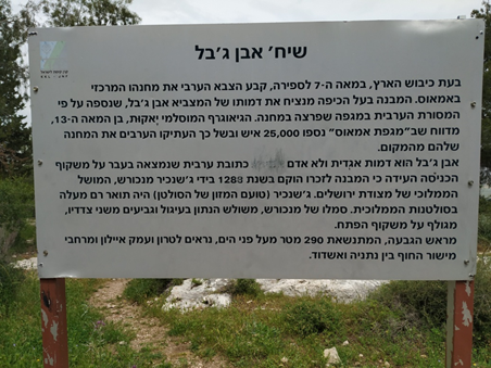
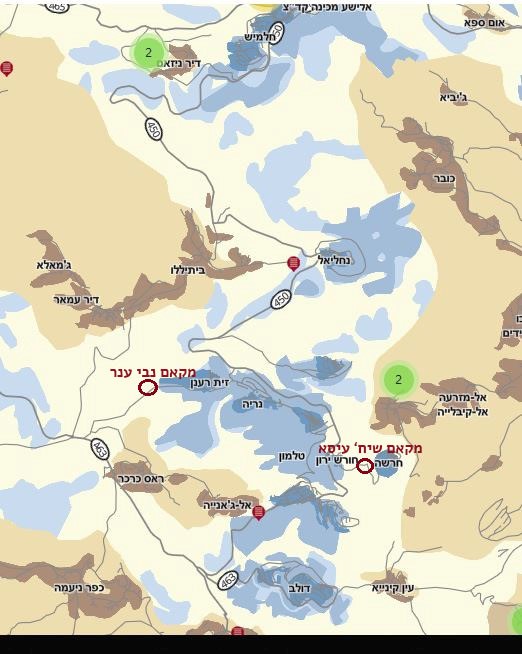
The Jewish settlers use this map extensively and plant contents that blame and badmouth Palestinians on the one hand, and construct the narrative according to which every archeological site dates from the days of the Second Jewish Temple in Jerusalem, or the Maccabees, or the Kings and Judges of Biblical lore. In this case where Ni’alan land belongs to the village, is located in Area B and some of it even Waqf (Muslim institutional property) containing remains of the Muslim sacred site maqam Anbar. We have not even managed to remedy the fact that Palestinian villages Yasouf and Iskaka are nowhere to be found on this map.
Feb-11-2019
The Jewish settlers use this map extensively and plant contents that blame and badmouth Palestinians on the one hand, and construct the narrative according to which every archeological site dates from the days of the Second Jewish Temple in Jerusalem, or the Maccabees, or the Kings and Judges of Biblical lore. In this case where Ni’alan land belongs to the village, is located in Area B and some of it even Waqf (Muslim institutional property) containing remains of the Muslim sacred site maqam Anbar. We have not even managed to remedy the fact that Palestinian villages Yasouf and Iskaka are nowhere to be found on this map.
Photographer: Irit Segoli
Feb-11-2019
Feb-11-2019
Photographer: Irit Segoli
Feb-11-2019
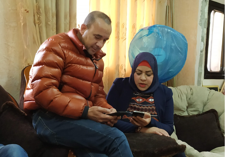
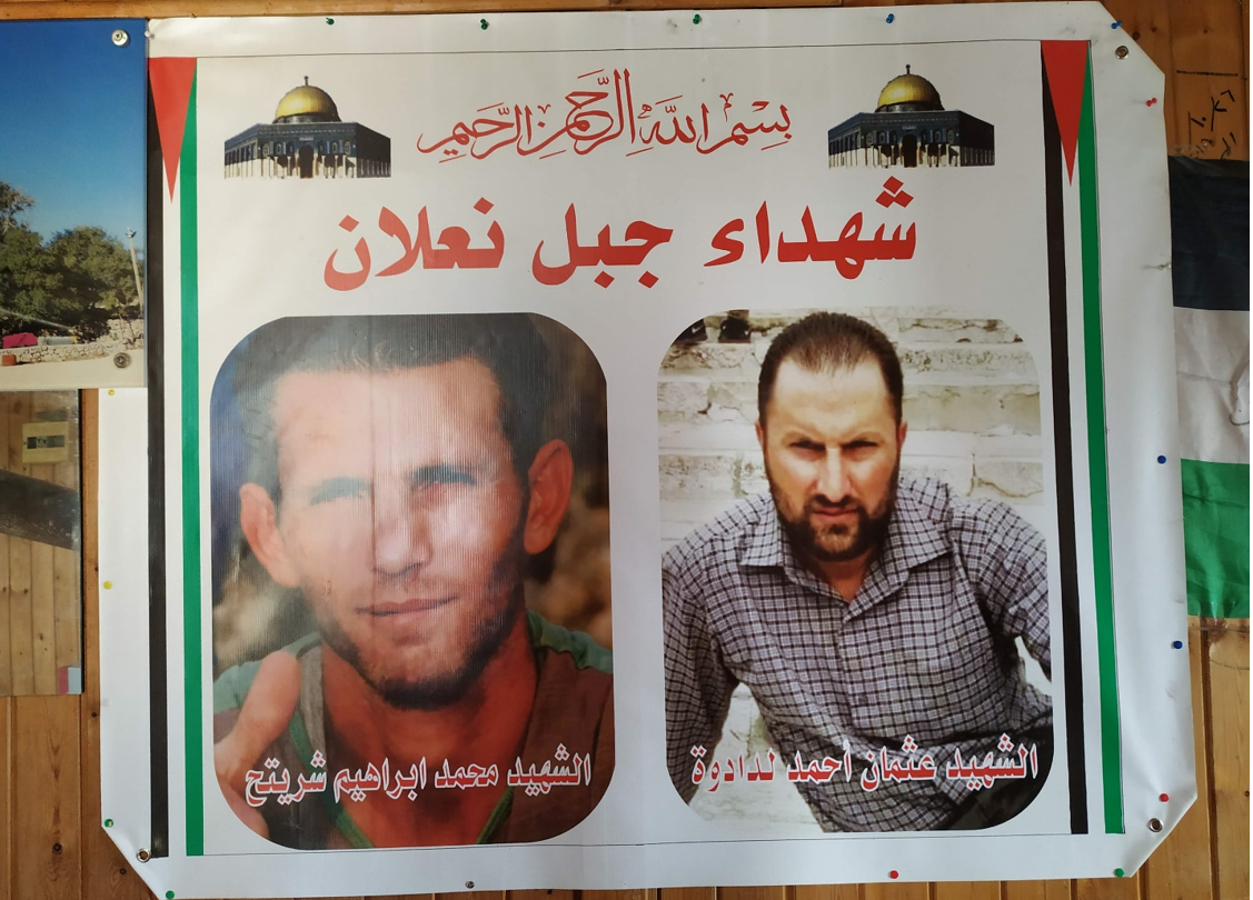
On the right, Othman Ahmad Ladawa, a 33-year old construction worker, father of four On the left, Mohammad Ibrahim Shirtah
Feb-11-2019
On the right, Othman Ahmad Ladawa, a 33-year old construction worker, father of four On the left, Mohammad Ibrahim Shirtah
Photographer: Irit Segoli
Feb-11-2019
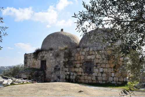
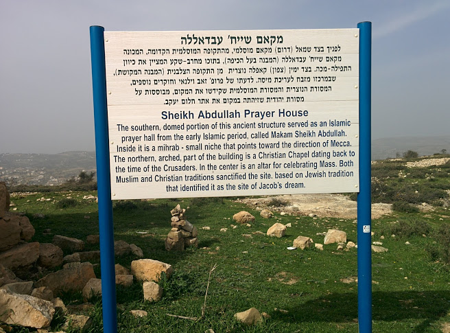
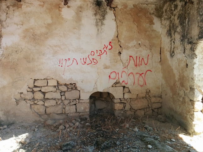
Maqam Nabi Anbar where the struggle with the Israeli army and the murder of the two Palestinians took place
Feb-11-2019
Maqam Nabi Anbar where the struggle with the Israeli army and the murder of the two Palestinians took place

Photographer: Irit Segoli
Feb-11-2019
Feb-11-2019
Photographer:
Feb-4-2019
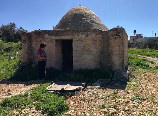
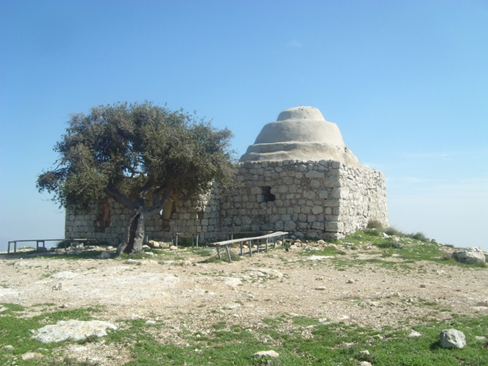
Maqam Sheikh Isa is located in the center of the Talmonim bloc, in an archaeological site where a system of underground wine presses and storerooms has been preserved, dating from the Iron Age (according to Wikipedia) and the Roman period (the period of the first and second temple).
Feb-4-2019
Maqam Sheikh Isa is located in the center of the Talmonim bloc, in an archaeological site where a system of underground wine presses and storerooms has been preserved, dating from the Iron Age (according to Wikipedia) and the Roman period (the period of the first and second temple).
Photographer: Nurit Popper
Feb-4-2019
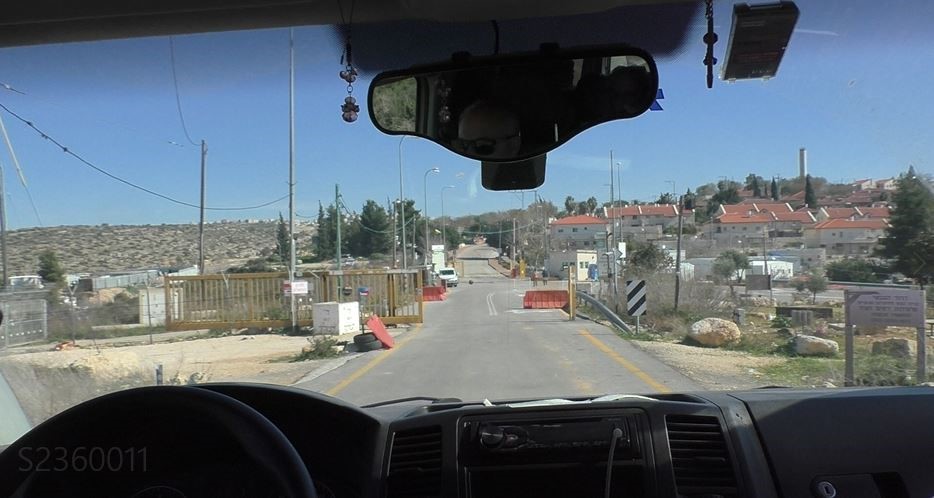
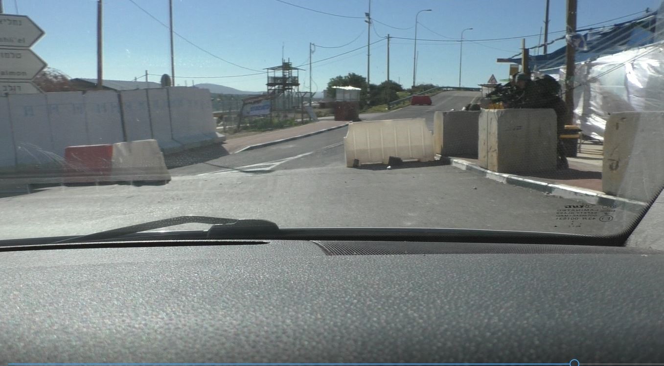
A checkpoint with a yellow gate blocks the entrance to the Nahliel settlement, the first of the bloc when you arrive from this direction. A plastic barrier and additional gate to the settlement are located beyond the yellow barrier. The settlement’s barrier opens for us, the privileged whose car bears Israeli license plates.
Feb-4-2019
A checkpoint with a yellow gate blocks the entrance to the Nahliel settlement, the first of the bloc when you arrive from this direction. A plastic barrier and additional gate to the settlement are located beyond the yellow barrier. The settlement’s barrier opens for us, the privileged whose car bears Israeli license plates.
Photographer: Nurit Popper
Feb-4-2019
Feb-4-2019
Photographer: Nurit Popper
Jan-21-2019
Jan-21-2019
Photographer: Nurit Popper
Jan-21-2019
Jan-21-2019

Photographer: Nurit Popper
Jan-21-2019
Jan-21-2019
Photographer: Nurit Popper
Jun-5-2018
Jun-5-2018

Photographer: Irit Segoli
Feb-21-2018
Feb-21-2018
Photographer: Irit Segoli
Mar-7-2018
Mar-7-2018
Photographer: Irit Segoli
Feb-7-2018
Feb-7-2018
Photographer: Irit Segoli
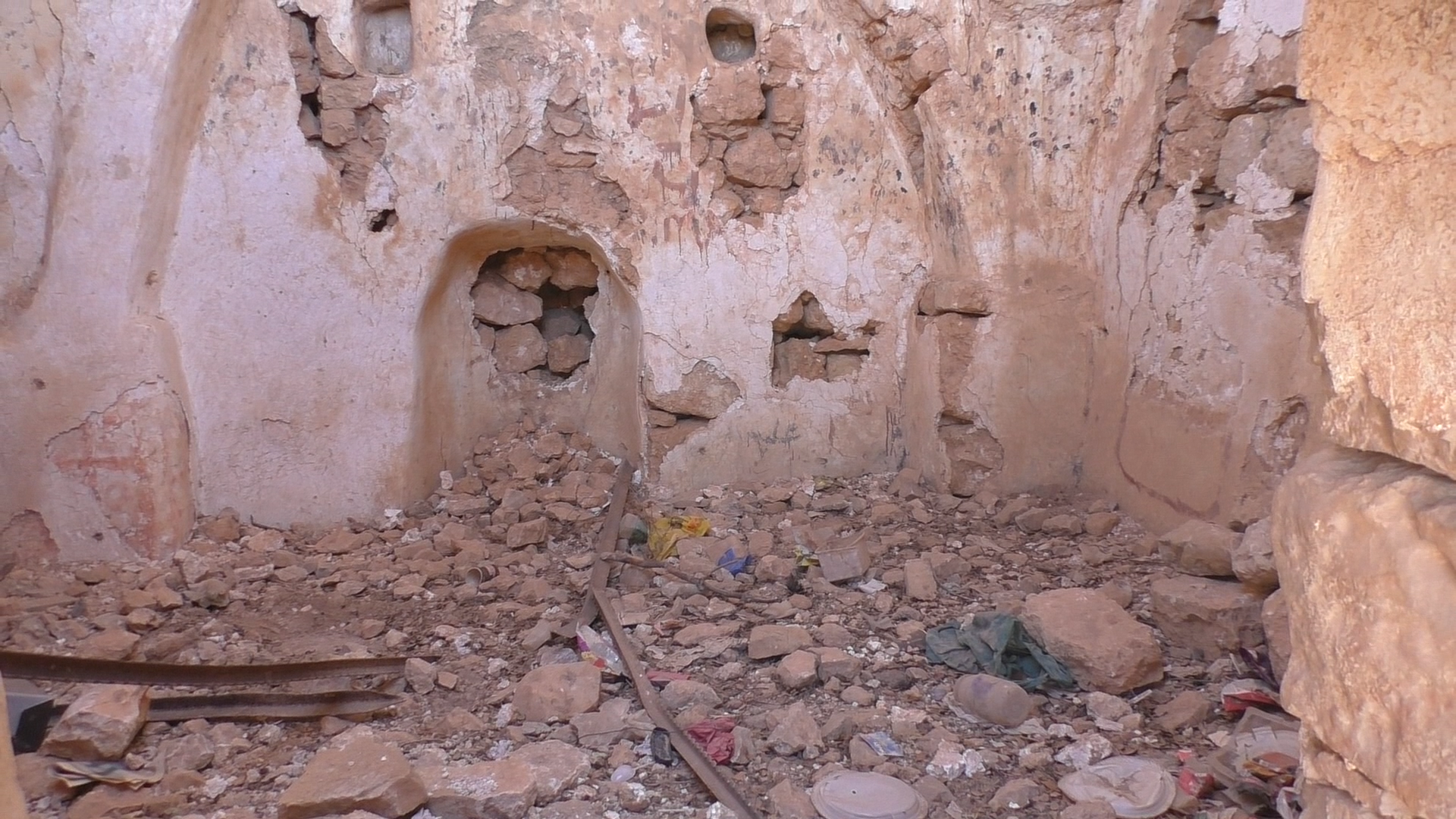
Aug-2-2017
Malicious graffiti in a ruined house near Maqam Abu Ismaiil
Aug-2-2017
Malicious graffiti in a ruined house near Maqam Abu Ismaiil
Photographer: Nurit Popper
Jul-27-2018
Maqam Seikh R'anem on mount Grizim
Jul-27-2018
Maqam Seikh R'anem on mount Grizim
Photographer:
Feb-28-2018
Feb-28-2018