Hebron vicinity Album
Photographer: Michal Tzadik
May-15-2013
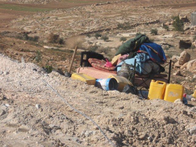
We turned off route 356 to the village of Ad Deirat and from there to a place called Huwwara or “Sha’ab al Mr’ar.” To see the well which was filled with cement and the "buildings" that were demolished. One was demolished this morning. Another one nearby was demolished last week. This is Area C. People showed us their applications for permits. None were approved. Although it’s their land it’s too close to the Ma’on settlement.
May-15-2013
We turned off route 356 to the village of Ad Deirat and from there to a place called Huwwara or “Sha’ab al Mr’ar.” To see the well which was filled with cement and the "buildings" that were demolished. One was demolished this morning. Another one nearby was demolished last week. This is Area C. People showed us their applications for permits. None were approved. Although it’s their land it’s too close to the Ma’on settlement.
Photographer: Michal Tzadik
Jun-1-2013
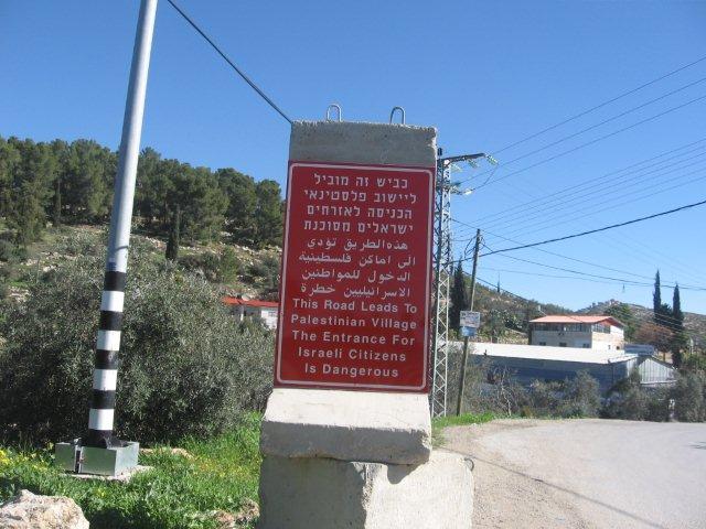
"This road leads to a Palestinian locality. Entry by Israeli citizens is dangerous." That’s different from the version referring to the prohibition against entering Area A, which is illegal. Such signs have recently been erected all along Highway 60, at all the entrances to Palestinian localities.
Jun-1-2013
"This road leads to a Palestinian locality. Entry by Israeli citizens is dangerous." That’s different from the version referring to the prohibition against entering Area A, which is illegal. Such signs have recently been erected all along Highway 60, at all the entrances to Palestinian localities.

Photographer: Michal Tzadik
Sep-14-2013
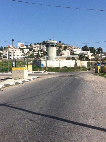
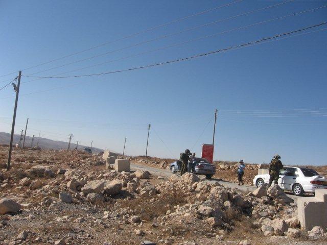
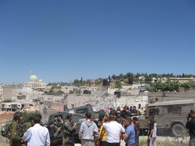
Israeli blue police detaining an Israeli vehicle at the entrance to Yatta, in area A, where Israelis are prohibited to enter.
Sep-14-2013
Israeli blue police detaining an Israeli vehicle at the entrance to Yatta, in area A, where Israelis are prohibited to enter.
Photographer: Michal Tzadik
Sep-15-2013
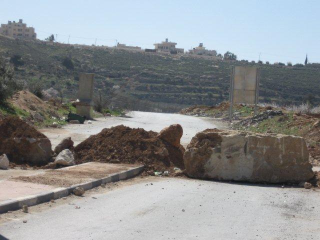
A new barrier on the way connecting Bani Na'im and route 60 was erected after the demonstrations yesterday. The vineyard belonging to the settler Menachem Livni is located on that route too and the barrier was erected between the vineyard and the town.
Sep-15-2013
A new barrier on the way connecting Bani Na'im and route 60 was erected after the demonstrations yesterday. The vineyard belonging to the settler Menachem Livni is located on that route too and the barrier was erected between the vineyard and the town.
Photographer: Hagit Back
Oct-25-2013
Oct-25-2013
Photographer: Hagit Back
Jan-25-2013
We entered the village of At Deirata on route 356, south of Zif junction. To see the ruins of a house that was demolished yesterday by the civil administration of the IDF. The “logic” behind the demolition is that the building was on private property and hadn’t received permits because they weren’t included in the village “authorized outline plan”…but the village doesn’t have an “authorized outline plan.” And does anyone really believe that if they’d asked for a permit they’d have received one?
Photographer: Raya Yeor
Mar-6-2013
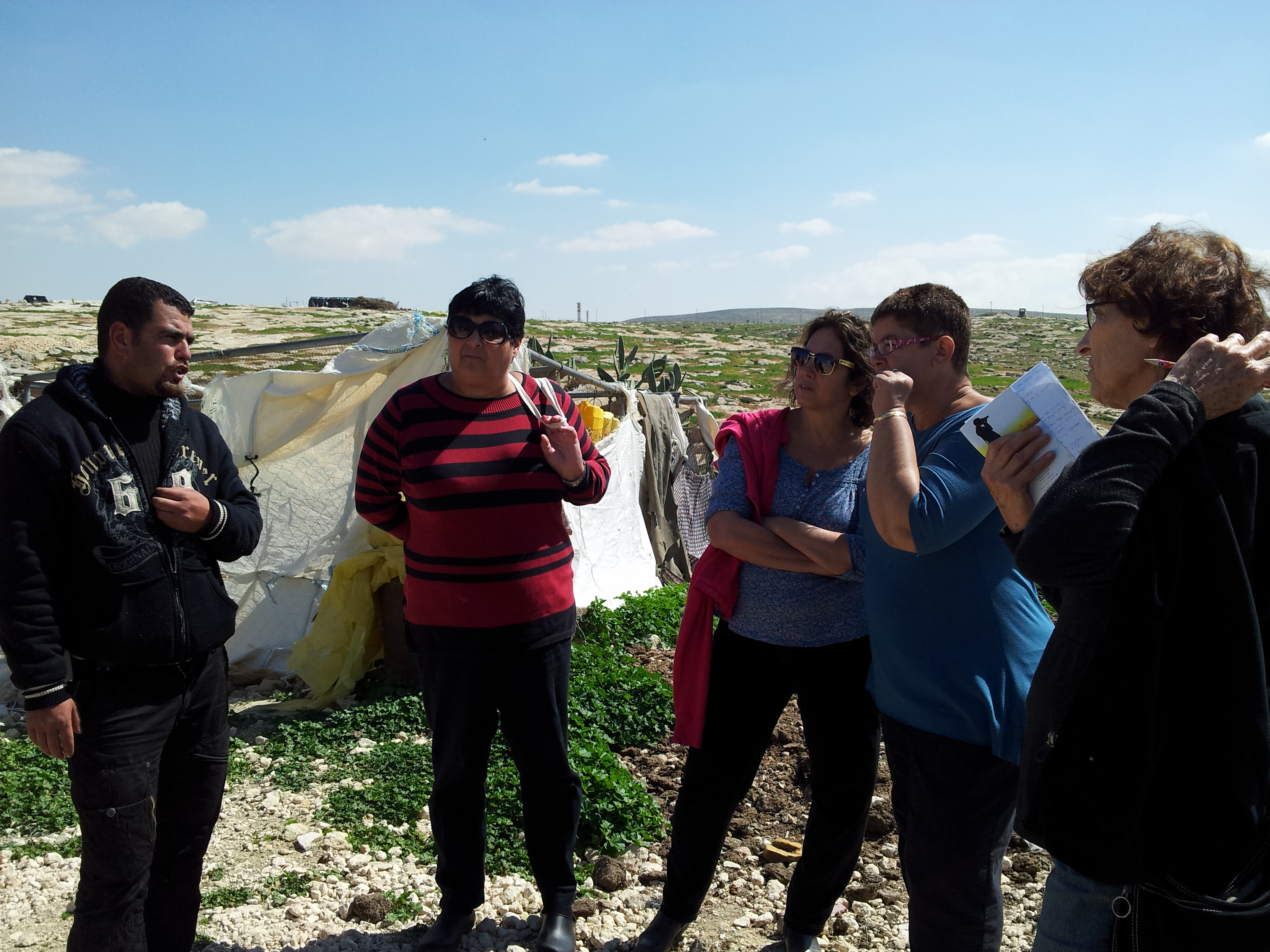
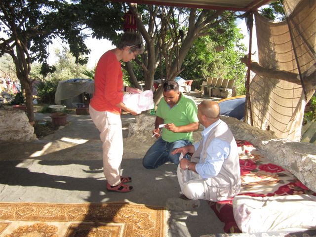
Meeting with Nasser, who works for B’Tselem and told us about the problems the villagers in the south Hebron hills having. See report from 06/03/2013
Mar-6-2013
Meeting with Nasser, who works for B’Tselem and told us about the problems the villagers in the south Hebron hills having. See report from 06/03/2013

Photographer: Michal Tzadik
Mar-14-2013
We drove to Hebron on route 317 to see the demolished mosque at Umm Faqra located on the southern slopes of the Ma’on settlement.
Mar-14-2013
We drove to Hebron on route 317 to see the demolished mosque at Umm Faqra located on the southern slopes of the Ma’on settlement.
Photographer: Michal Tzadik
Mar-14-2013
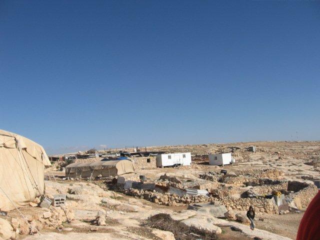
View of Umm Faqra village with small white buildings donated by the United Nations org. to families in the village.
Mar-14-2013
View of Umm Faqra village with small white buildings donated by the United Nations org. to families in the village.

Photographer: Michal Tzadik
Mar-14-2013
Mar-14-2013

Photographer: Michal Tzadik
Mar-16-2013
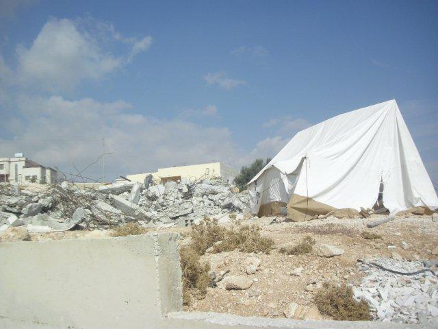
Demolitions in Suseya by the IDF.
Mar-16-2013
Demolitions in Suseya by the IDF.

Photographer: Michal Tzadik
Mar-16-2013
Demolitions in Suseya by the IDF.
Mar-16-2013
Demolitions in Suseya by the IDF.
Photographer: Michal Tzadik
Mar-16-2013
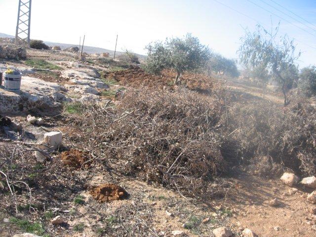
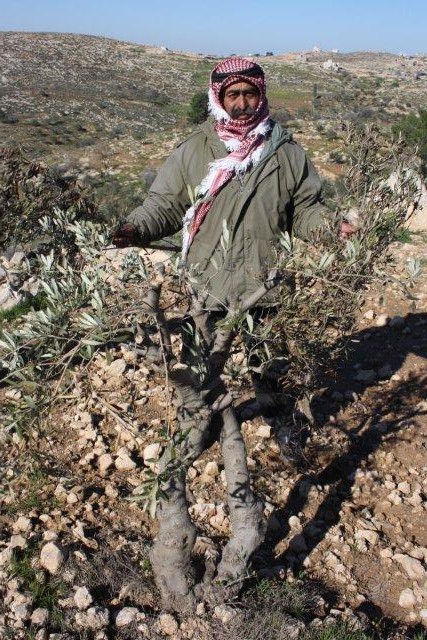
Uprooting olive trees by the IDF.
Mar-16-2013
Uprooting olive trees by the IDF.
Photographer: Michal Tzadik
Jan-11-2013
Next to a military post on the road leading to Massafer Yata, a few soldiers from the Shimshon Brigade detained cars, conducted searches, and examined cars with yellow registration plaques (Israeli).
Jan-11-2013
Next to a military post on the road leading to Massafer Yata, a few soldiers from the Shimshon Brigade detained cars, conducted searches, and examined cars with yellow registration plaques (Israeli).
Photographer: Michal Tzadik
Jan-11-2013
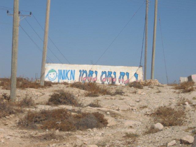
In the middle of nowhere a new poster of "Na, Nach, Nachman, from Uman" was erected.
Jan-11-2013
In the middle of nowhere a new poster of "Na, Nach, Nachman, from Uman" was erected.
Photographer: Michal Tzadik
Jan-18-2013
Jan-18-2013
Photographer: Michal Tzadik
Jan-18-2013
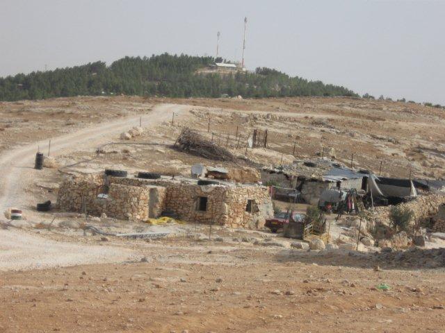
Al Mafkara and on top of the hill is located Ma'on settlement.
Jan-18-2013
Al Mafkara and on top of the hill is located Ma'on settlement.
Photographer: Michal Tzadik
Jan-18-2013
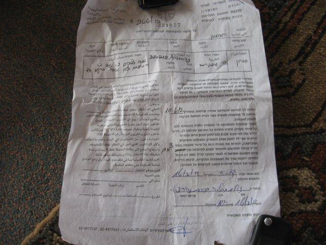
A demolition order to a building in the village, issued by the IDF on June 2012.
Jan-18-2013
A demolition order to a building in the village, issued by the IDF on June 2012.
Photographer: Michal Tzadik
Nov-12-2012
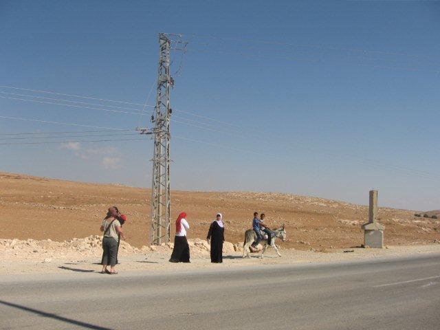
Little children and women carrying infants walking along route 60 from Yatta, apparently on their way to the clinic at Khirbet Tawwani. They must walk for a few kilometers along an unpaved, as well as cross a main highway.
Nov-12-2012
Little children and women carrying infants walking along route 60 from Yatta, apparently on their way to the clinic at Khirbet Tawwani. They must walk for a few kilometers along an unpaved, as well as cross a main highway.
Photographer: Michal Tzadik
Nov-12-2012
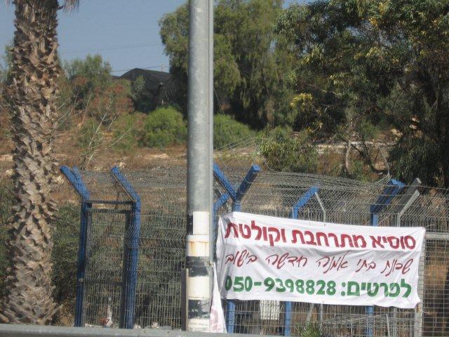
Large banners announce the expanding of Sussiya settlement.
Nov-12-2012
Large banners announce the expanding of Sussiya settlement.
Photographer: Michal Tzadik
Nov-13-2012
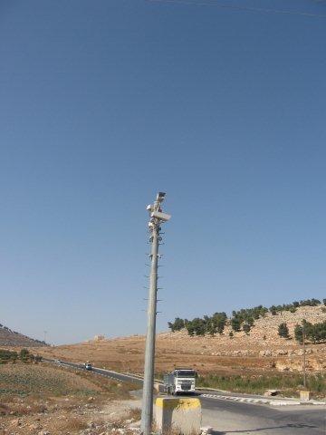
At Dura Al Fawwar junction there are new poles with cameras.
Nov-13-2012
At Dura Al Fawwar junction there are new poles with cameras.
Photographer: Paula Rubinek
Dec-2-2012
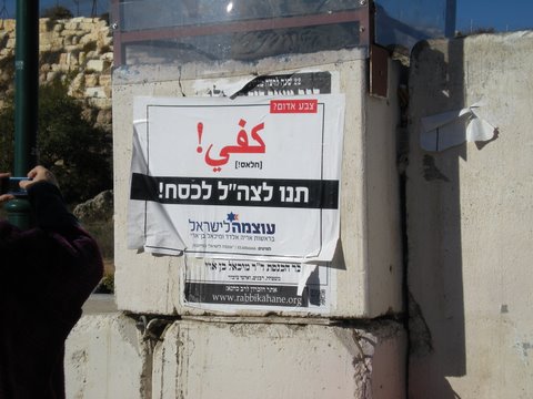
"Let the IDF beat and humiliate" a poster for the coming election by the Otzma Le Israel Party (Power to Israel).
Dec-2-2012
"Let the IDF beat and humiliate" a poster for the coming election by the Otzma Le Israel Party (Power to Israel).
Photographer: Chaya Offek
Jul-3-2012
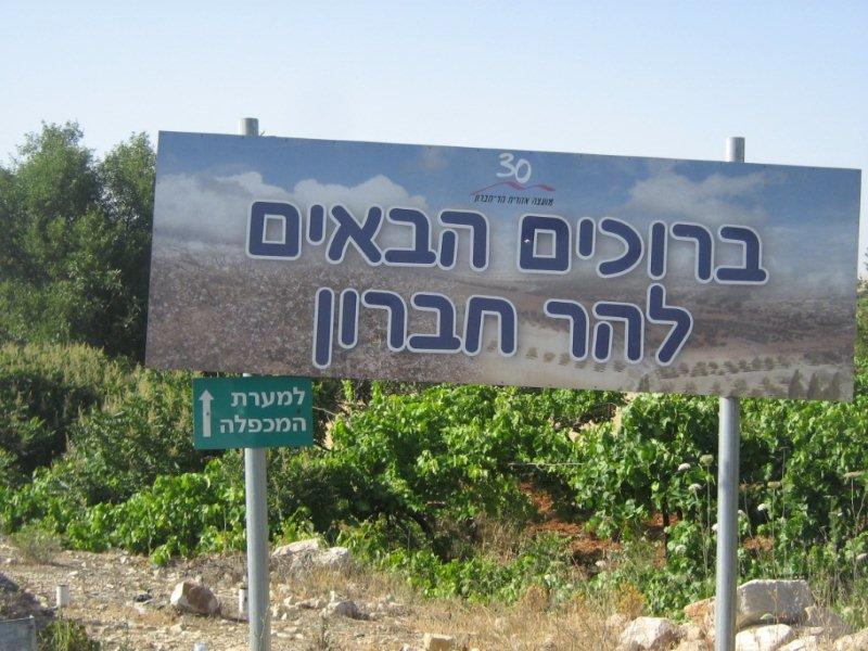
"Welcome to Mount Hebron region".
Jul-3-2012
"Welcome to Mount Hebron region".
Photographer: Michal Tzadik
Jun-6-2012
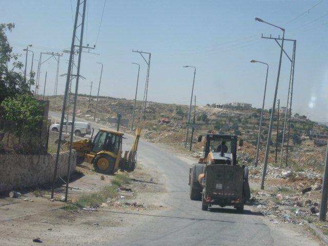
While approaching Hebron we saw a caravan: three Civil Administration vehicles, then a large tractor, then another, then three army jeeps. It seems to be, without any doubt, a demolition taskforce. They turned left onto the road leading to the Kiryat Arba industrial zone, located at the southeastern out skirts of the city. We followed them.
Jun-6-2012
While approaching Hebron we saw a caravan: three Civil Administration vehicles, then a large tractor, then another, then three army jeeps. It seems to be, without any doubt, a demolition taskforce. They turned left onto the road leading to the Kiryat Arba industrial zone, located at the southeastern out skirts of the city. We followed them.
Photographer: Michal Tzadik
Jun-6-2012
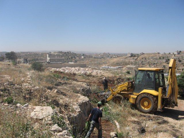
The civil administration backed by the IDF uprooting the orchard at Jabel Jalis.
Jun-6-2012
The civil administration backed by the IDF uprooting the orchard at Jabel Jalis.
Photographer: Michal Tzadik
Jun-6-2012
The residents confront the IDF.
Jun-6-2012
The residents confront the IDF.
Photographer: Natanya Ginsburg
Jun-7-2012
We visited Mahmud who lives next to the checkpoint, whose car was confiscated by the blue police. He bought the car for parts but he has been using it to go to Yata to buy provisions and took his elderly mother to the doctor.
Jun-7-2012
We visited Mahmud who lives next to the checkpoint, whose car was confiscated by the blue police. He bought the car for parts but he has been using it to go to Yata to buy provisions and took his elderly mother to the doctor.
Photographer: Natanya Ginsburg
Jun-7-2012
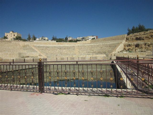
On the way back we stopped at the village of Yatta to see the big pool which does not seem to be used for anything and which has a stadium around it which Muhamed says is ancient but seems to have been renovated.
Jun-7-2012
On the way back we stopped at the village of Yatta to see the big pool which does not seem to be used for anything and which has a stadium around it which Muhamed says is ancient but seems to have been renovated.
Photographer:
Jun-28-2012
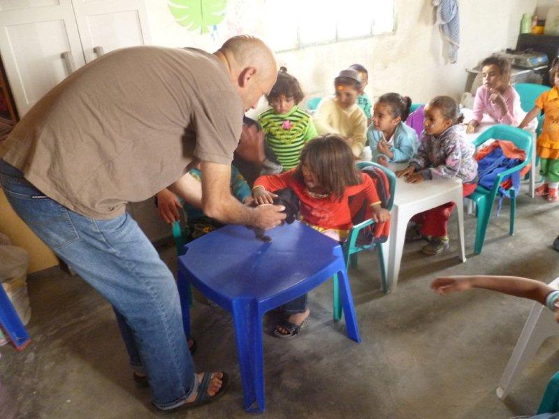
Today’s activity was organized by Yirmy who uses animals to teach children about nature.
Jun-28-2012
Today’s activity was organized by Yirmy who uses animals to teach children about nature.
Photographer: Judy Auerbach
May-31-2012
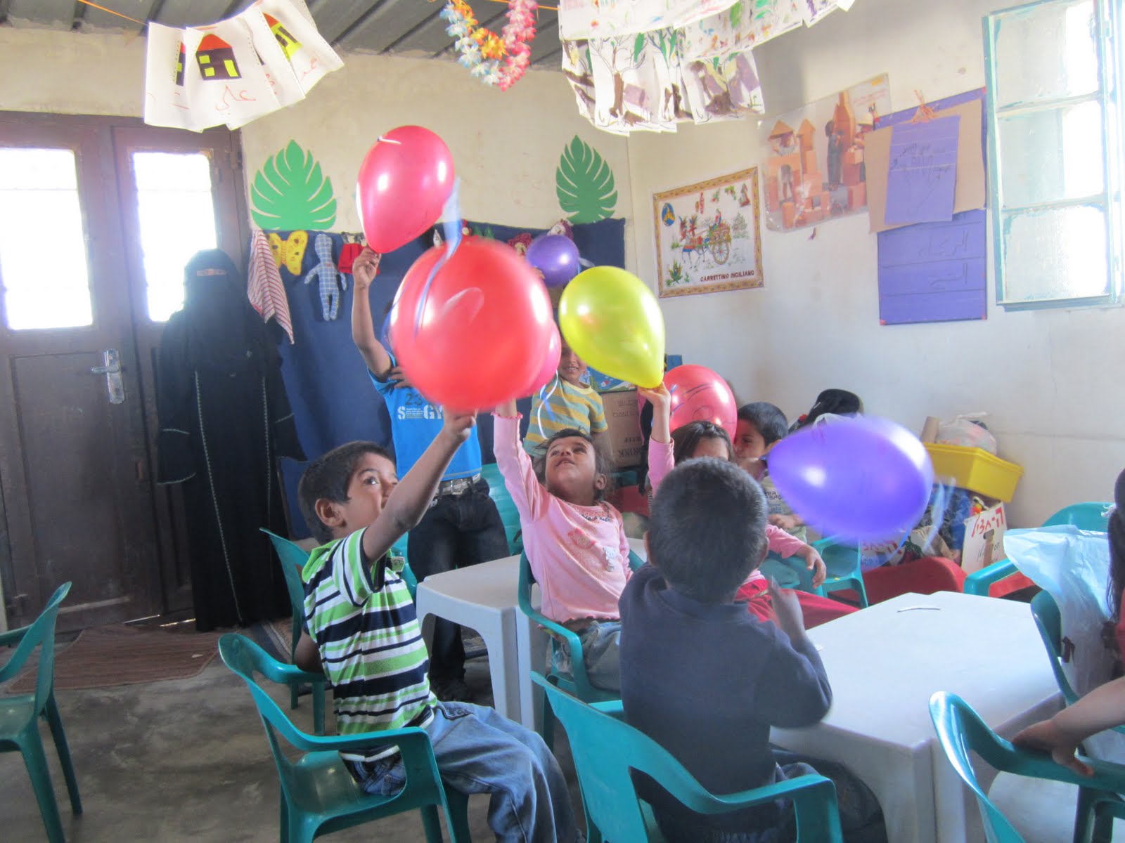
20 children were present in the preschool for today’s activity with balloons.
May-31-2012
20 children were present in the preschool for today’s activity with balloons.
Photographer: Michal Tzadik
Mar-10-2012
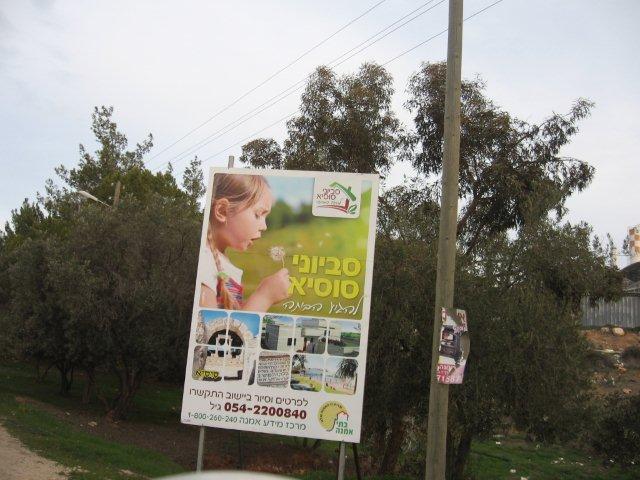
A poster promoting a new neighborhood in Susiya settlement, in the south Hebron's hills.
Mar-10-2012
A poster promoting a new neighborhood in Susiya settlement, in the south Hebron's hills.
Photographer: Michal Tzadik
Mar-10-2012
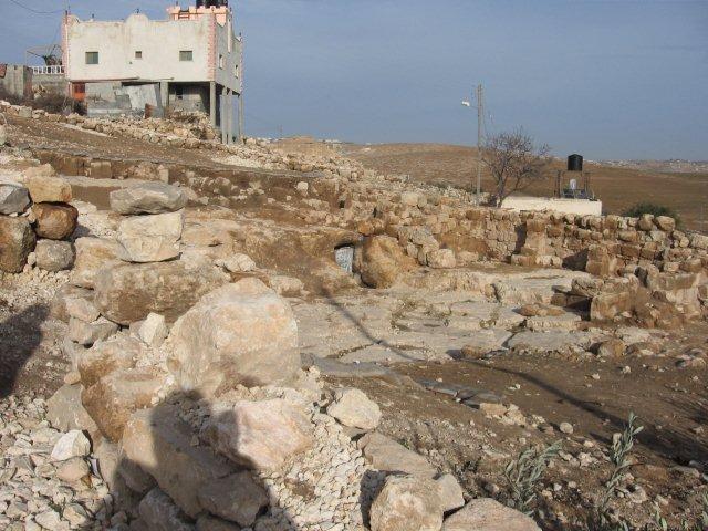
The IDF decided to bring water to At Tuwani, while they were digging they discovered among the village houses archaeological remains from the Roman and Byzantine periods (what Israeli locality doesn’t sit on an archaeological site?). Now they can't put the water pipe and the site turned to be a tourist site for Israelis without water.
Mar-10-2012
The IDF decided to bring water to At Tuwani, while they were digging they discovered among the village houses archaeological remains from the Roman and Byzantine periods (what Israeli locality doesn’t sit on an archaeological site?). Now they can't put the water pipe and the site turned to be a tourist site for Israelis without water.
Photographer: Michal Tzadik
Mar-10-2012
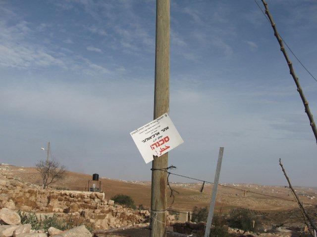
The sign declares the site as an archaeological remains site.
Mar-10-2012
The sign declares the site as an archaeological remains site.
Photographer: Natanya Ginsburg
Mar-10-2012
Olive tree branches were broken probably by settlers from Eshtamoa outpost which is overlooking Khirbet Shuweika's fields.
Mar-10-2012
Olive tree branches were broken probably by settlers from Eshtamoa outpost which is overlooking Khirbet Shuweika's fields.
Photographer: Michal Tzadik
Mar-11-2012
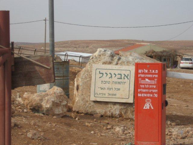
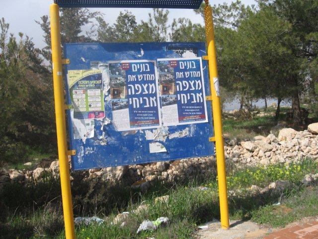
Posters promoting the reconstructing Avichai outpost which was evacuated are scattered all over Hebron and the Hebron vicinity.
Mar-11-2012
Posters promoting the reconstructing Avichai outpost which was evacuated are scattered all over Hebron and the Hebron vicinity.
Photographer: Natanya Ginsburg
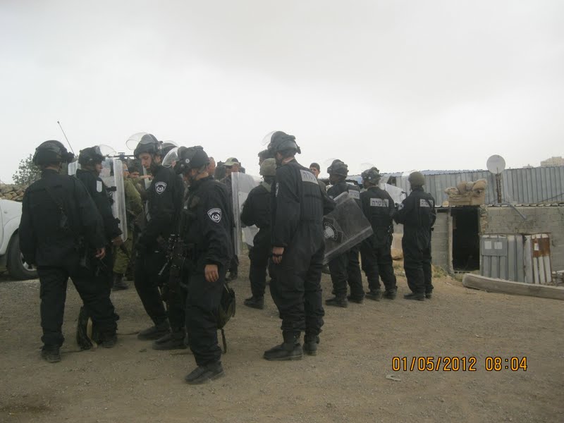
May-1-2012
The parking lot in Kiryat Arba was filled with soldiers, police, jeeps and bulldozers. We decided to follow the convoy arriving on Road 60 near to the turnoff to Road 356. More jeeps, police, etc. were waiting. They had come to demolish several sheds which had been built for cattle belonging to two brothers from the Rajabi family of Hebron. The owners said that they had received warning that the army was coming to destroy their buildings. He also said that they had built on agricultural lands and I wanted to know if cows were not also agricultural in the broad sense of the word.