Beitunia
Beitunia’s lands, including olive groves, nature preserves, and sacred maqams, are penned in by the separation fence.
Our destination: The Beitunia ridge, bounded by Highway 443, the Ofer military base, Beit Horon, and the separation fence. Dror Etkes, from “Gan Na’ul,” estimates that it includes more than 14,000 dunums. The Palestinian residents have no access to the area. A week prior to our visit we were guests of the Beitunia municipality. The fence is visible from the building’s windows – a reminder of its inaccessibility.
We were told that 80% of their land is trapped there. Olive groves, springs and important maqams that had served as sites of worship and gathering are now beyond the fence. Landowners are permitted entry only three days a year, to harvest their olives. Of course, that’s insufficient for cultivating the trees and harvesting the fruit.
We made an appointment to visit the closed area with its olive groves and its natural and cultural treasures. We should note that since the area is closed, wildlife is trapped there too, including dozens of deer.
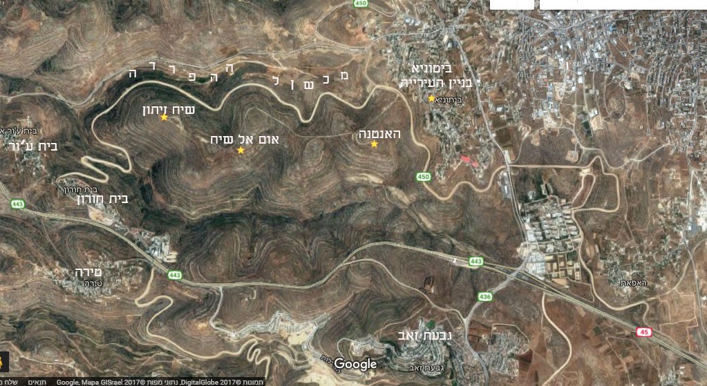 |
South of Highway 443, between it and Highway 1 which runs parallel to it, these settlements have been established: Giv’at Ze’ev, Giv’on Hahadasha, Nebi Samu’el, and the various neighborhoods of Ramot. Thus a corridor of Jewish localities has been established, linking the area with Jerusalem and separating the Palestinian villages on either side.
The area is surrounded by walls and fences; access is through two gates : The Ofer military base, a gate for Palestinians who own olive groves, and for Israelis via the Mavo Horon settlement, after coordination with the military.
The meeting at the entrance to the Beit Horon settlement was scheduled for 11:00. We had to wait more than half an hour for the Border Police to arrive. They have the keys to the gate. And then, a ten-minute drive on the security road to a gate that has been opened for us. A male and female soldier, both armed, escorted us during our visit.
The security road along which we have driven passes near Beitunia’s houses, tangential to the western neighborhood. The municipal building (that we have visited last week) is located in this neighborhood, and from it the route of the fence is clearly visible. A prominent scar on the landscape.
 |
The guide, Neria Antman, introduces himself. He usually accompanies schoolchildren, mostly from Binyamin and Shomron. He was born and raised in Kedumim. He is married. He has lived in Amona until the evacuation, and ow lives in Ofra.
Our first stop: Altitude marker 822, the Sheikh Zeytoun ridge. The view is uninterrupted in all directions. A tall antenna on the hilltop, whose cameras and listening posts are aimed at Beitunia and Ramallah.
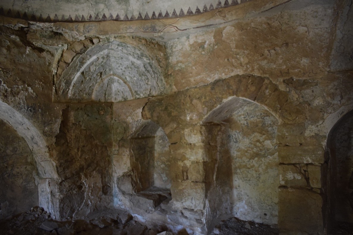
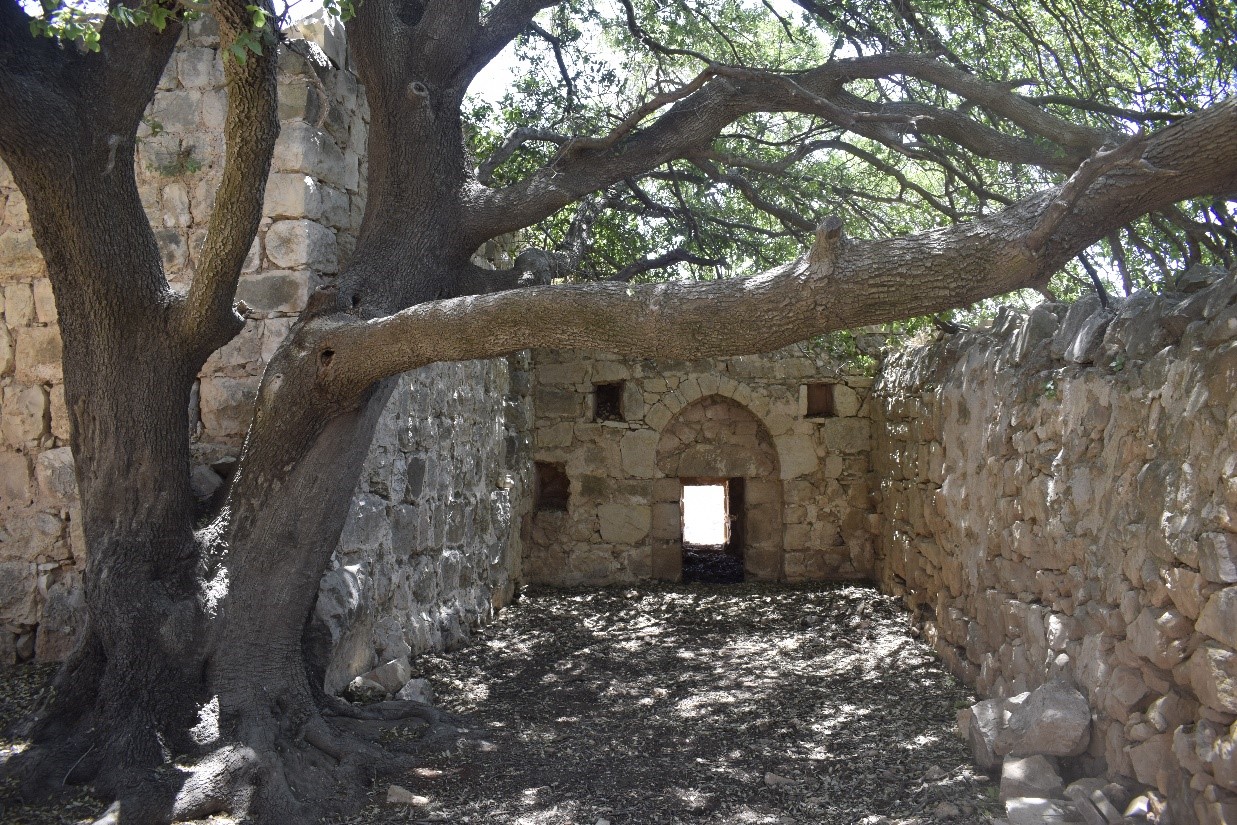
Second stop: Umm el Sheikh (the sheikh’s mother). The path is rocky and difficult, especially under the burning sun. We finally reach a lovely maqam. The inner rooms have colorful decorations and layers of peeling plaster. Outside there is a pleasant seating area in the shade of an ancient oak. Holes at the base of its trunk, apparently made by a tree-boring insect. The site looks neglected, both the ancient structure and the old tree beside it. The guide has no information about the site. Nor does the guide’s guest, who works for the Antiquities Authority and the Civil Administration on the West Bank, know anything. He deals with thefts of antiquities.
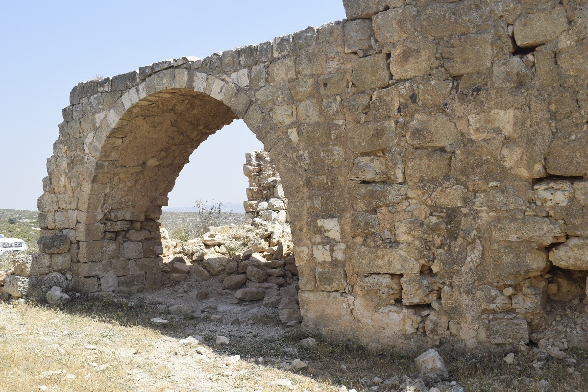
Third stop: the remains of an ancient church, apparently from Byzantine times. “iNature” states there was once a magnificent mosaic floor here, which was taken to the museum in Ma’aleh Adumim. Of course, no one bothered to notify the owner of the site that the antiquities were being removed. They made sure to keep them in the territory of the West Bank. Transferring them to Israel would have been considered antiquity theft under international law.
Fourth stop: Sheikh Zeitoun. It’s at the end of the salient. The view is magnificent. According to “iNature,” local tradition has it that Sheikh Zeitoun’s tomb was revealed after a pillar of fire struck the ridge in broad daylight. The following night a saint appeared to the sheikh’s wife, who was buried at Umm el Sheikh, and told her that a large olive tree had sprang up at the location struck by the pillar of fire. In commemoration of the event, the villagers erected a maqam there and called the site Sheikh Zeitoun.
In summary: The entire area is desolate. The olive groves aren’t being taken care of. The antiquities sites are neglected. Though excavations were conducted, they were done without obtaining permission from the landowners and the finds were removed to the museum in Ma’aleh Adumim. Ancient trees, such as the oak at Umm el Sheikh, are being damaged by infestations and may collapse if not treated. The lovely maqams are crumbling, turning into ruins. Since the location is both an archaeological and a nature site, questions arise: What’s the plan? Who’s responsible for preservation? What excavations are underway? Is there an intention to date the site to the First and Second Temple periods, as we’ve seen at other sites in the area? The place is crying out for restoration. The site should be better known in order to rehabilitate it in a manner that will preserve its character and provide free access to the landowners to cultivate their lands, and also provide access to the maqams.
 |