Palestinian Heritage Sites are swallowed by the settler-colonies
Palestinian Heritage Sites are swallowed by the settler-colonies: thus, the fence surrounding the maqam at Marda village
No sign of the Marda maqam after the fence of Ariel settler-colony was completed.
Marda – 55% of the lands inhabited by the Israeli settler-colony Ariel belong to the Palestinian village of Marda. When the separation fence was built, the maqam Sheikh Ahmad Al Qasab was destroyed. It is still marked in the Amud Anan map. Our older members knew it as a village closed off by a yellow metal gate that could be locked, thus isolating the Marda villagers.
In Marda we met local council member Hussan Ras, who told us that in the past Marda was the hub of the region’s villages. Its lands reached the town of Salfeet. It had three water sources of its own and would supply water to the surrounding villages. Nowadays the village suffers severe water shortage, after the Israeli national water company, Mekorot, took over all of these sources.
Yasouf – between Yassouf and Iskaka is a double-domed maqam named Abu Zrayed. By Israel the site is named Tapuach Oak Reserve, its area amounting to 29 dunams and approved by the Judea and Samaria (West bank) council. Although we did not receive permission to photograph it from the local council, several days later they phoned us to our Machsomwatch that appears on the visiting card we left there.
Farkha (Arabic for chick) – a small village southwest of Salfeet. It too suffers water and sanitation problems according to the report we received from the village council. Close to the village, inside a cemetery with a large ancient oak tree, stands a ruined maqam named Sheikh Abu Abed. Settler-colonists attribute it to one of the Judges, Hilel Ben Abdun. (The maqam in Far’ata is claimed by the Havat Gil’ad settler-colonists to be attributed to that very same Hilel ben Abdun).
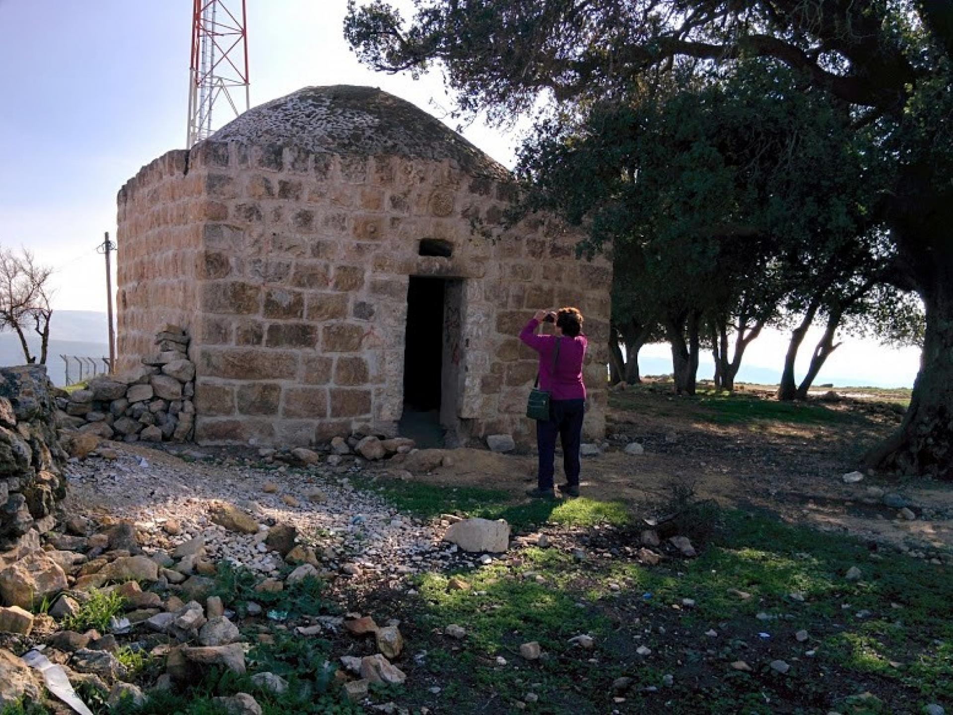
From Farkha we drove through the village of Amouriya to Taruja Mountain, where ancient oak trees grow on its peak. This is the site of maqam Sheikh Abu Zayed, named after a Sufi sage of Arura village. In the Israeli map the site is named Har Efrayim observation point. The hilltops bear the settler-colonies of Eli and Maale Levona. The reserve called Sheikh A Zayed is approved by the West Bank Israeli council, its area 50 dunams (not yet “administered” as a reserve). At the top of this range are Palestinian telecommunication antennas.
In the Palestinian village of Amouria we were told that youngsters of the village party around the maqam.
Turning the two Palestinian sites of heritage and ritual – maqam Sheikh Zayed and maqam Sheikh Abu Zrayed – into “nature reserves” clearly exposes the occupation authorities’ agenda, namely to turn them into recreation areas for the welfare of Israeli settler-colonies.
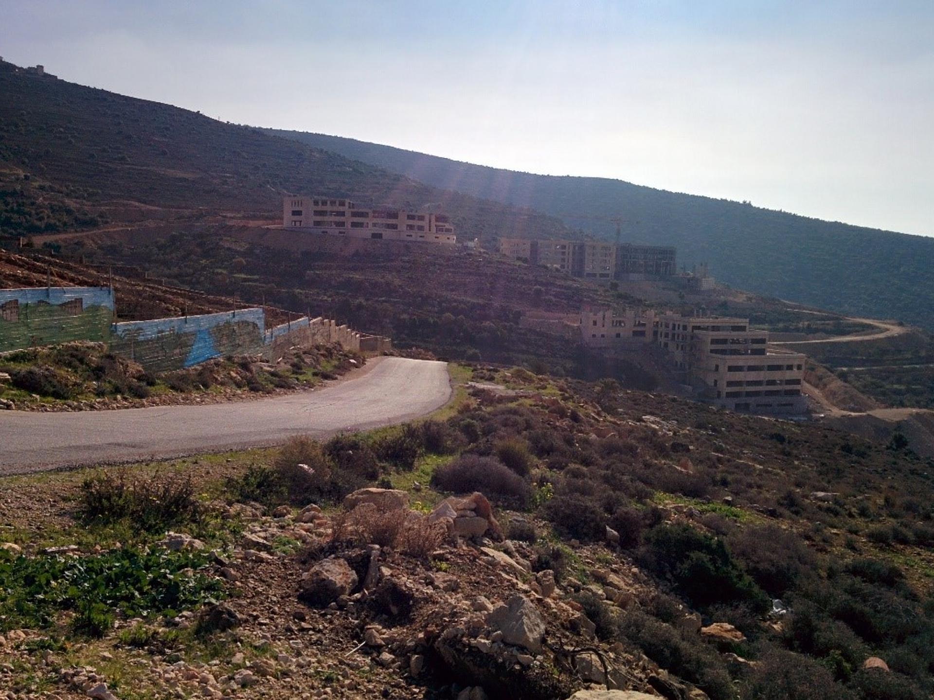
On our way back to Salfeet, we passed by a beautiful new building under construction. We were told this is a private university named Zaytoun, intended to serve the Palestinian population in the area. There we met its entrepreneur and biotechnology specialist Dr. Daoud who will manage the new university. At present he lives in Hebron.