Duma, Jurish
Duma
We met Z., the secretary of the Mejeles, and talked with him about the water problem. Duma is situated last among the villages on the water supply line, and that is why there were supply problems in the summer, and from time to time the water stopped flowing in the faucets. The council was obliged to buy water in containers at an inflated price of 40 NIS per cubic meter. Lately there was an agreement with Mekorot (the water company) to pump from a nearer well, and the situation ameliorated.
Once, the secretary remembered, there were three springs at the Paza’el region, from which water was pumped for the villages. For about 10 years now there is no water in them at all.
He had no exact data about the quantities supplied by Mekorot.
The meeting was arranged spontaneously, therefore the head of the Council wasn’t present.
We visited Husein Daubshe on the occasion of the homecoming of Mohamed, and proceeded to a short conversation with M., a woman council member.
Jorish
We came at the invitation of A.P., the head of the Council.
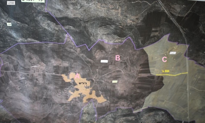
Lately the Public Works Authority put up an obstruction to the path which connected Jorish with Road 505. This is the short way to reach Jorish from the main road; otherwise the villagers are forced to drive 6.5 kilometers more by way of Kussara, where the road is congested , especially in the morning hours when schoolchildren go to school, and come back from school at noon.
T., who assists the head of the council in this matter, and who speakes fluent Hebrew, explained that part of that road was paved in Zone B, with the concent of the civil administration . It was covered by asphalt (financed by the Danes) and at the same time they filed a request with the civil administration to continue paving the part of the road that connects to the main road (an additional 800 meters), which is situated in zone C.
They submitted all the engineering plans they were asked to submit, including aerial photographs., and the civil administration reacted by making new illogical demands that they could not accept:
a. That the road be 17 meters wide (it is a side road, used only by the inhabitants of Jorish. No other villages use this road). Even so the council was willing to accept this demand. For comparison’s sake, the present paved road is 6-7 meters wide.
b. Margins of 40 meters on each side. Such margins would necessitate extensive land expropriations. These lands are in part cultivated by the inhabitants, and are all under private ownership, so they absolutely cannot agree to this demand. Moreover, this is not a main road but a path leading to their village, and the demands seem arbitrary and certainly exaggerated.
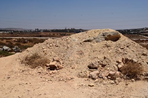
Two years have passed and the inhabitants continued to use the dirt road in order to reach the village by the short route. A year ago the Public Works Authority made a ditch in the dirt road, to make the passage more difficult, and lately they blocked the road by a mound of dirt to completely prevent the passage of cars from road 505 to the village.
·
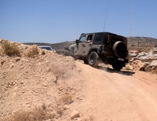
While we were walking around the mound a military jeep passed us on the road to the village. The soldiers looked at us but didn’t stop. The jeep entered the village, turned around and left.
On the way back, an unusual number of military vehicles disrupted the beautiful landscape of the valley: at the entrance to Ossrin, a few military jeeps, a police vehicle, 4 soldiers and a prisoners’ patrol vehicle were standing. A military armored car passed us east of Tapuah, and at the Tapuach intersection, a military jeep was parked on the side of the road, in addition to the usual vehicle inventory.