Regarding the apartheid road and the theft of maqams sacred to Palestinians
Checkpoints on the settlement road, highway 450
Highway 450 begins near the entrance to Halamish settlement and continues to the pair of settlements Talmon – Dolev. The road winds through a forested, hilly region. Its northern portion borders the Deir Nizam forest preserve and the Palestinian villages of Deir Nizam and Beitilelu. It’s a road from Mandatory times which for decades prior to the occupation served as a link among the local villages.
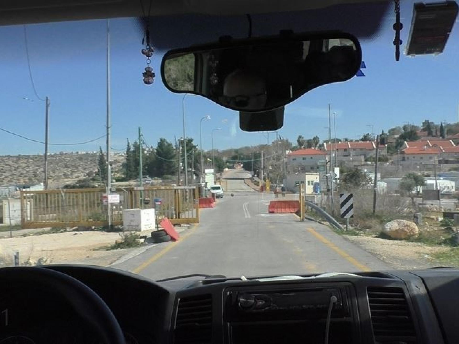
Two years ago the entry to highway 450 near the Halamish settlement took on a new aspect. The settlement is on one side, to the east a concrete wall concealing the new outpost established immediately after the murder of the family in Halamish. The (‘illegal”) outpost kept growing. Soldiers behind concrete barriers, weapons aimed at the highway, greet travelers.
The road continues toward Beitilelu. On the way, before the right turn to Deir Nizam, a similar sight: a plastic checkpoint on the road and soldiers in a guard post observing those passing. A week later they had begun checking documents. The guard’s laconic response was, “we’re looking for someone.”
Farther along the road is a turn to Wadi Zarqa. The area is lovely, with abundant water and flourishing crops. It was declared a nature preserve. The hiking map of the Israel Mapping Center colors the area yellow, which indicates Area B. But that doesn’t keep settlers from coming to enjoy the natural springs and the huge pool built by a local Palestinian for the benefit of the villagers.
For the first time we saw signs erected by the Palestinian Authority indicating the turn to Wadi Zarqa and to the pool, along with phone numbers for coordinating a visit.
About one kilometer farther south is the entrance to Beitilelu. After the murder in Halamish a yellow barrier was erected there. At first the barrier blocked exit from the village from this direction, but after Attorney Neta Amar went to court the barrier was opened.
Today we saw the checkpoint had been moved to another location, and only the red warning sign by the roadside announces to Israelis that they are entering dangerous Palestinian territory.
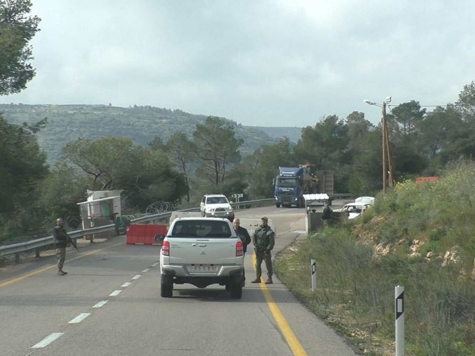
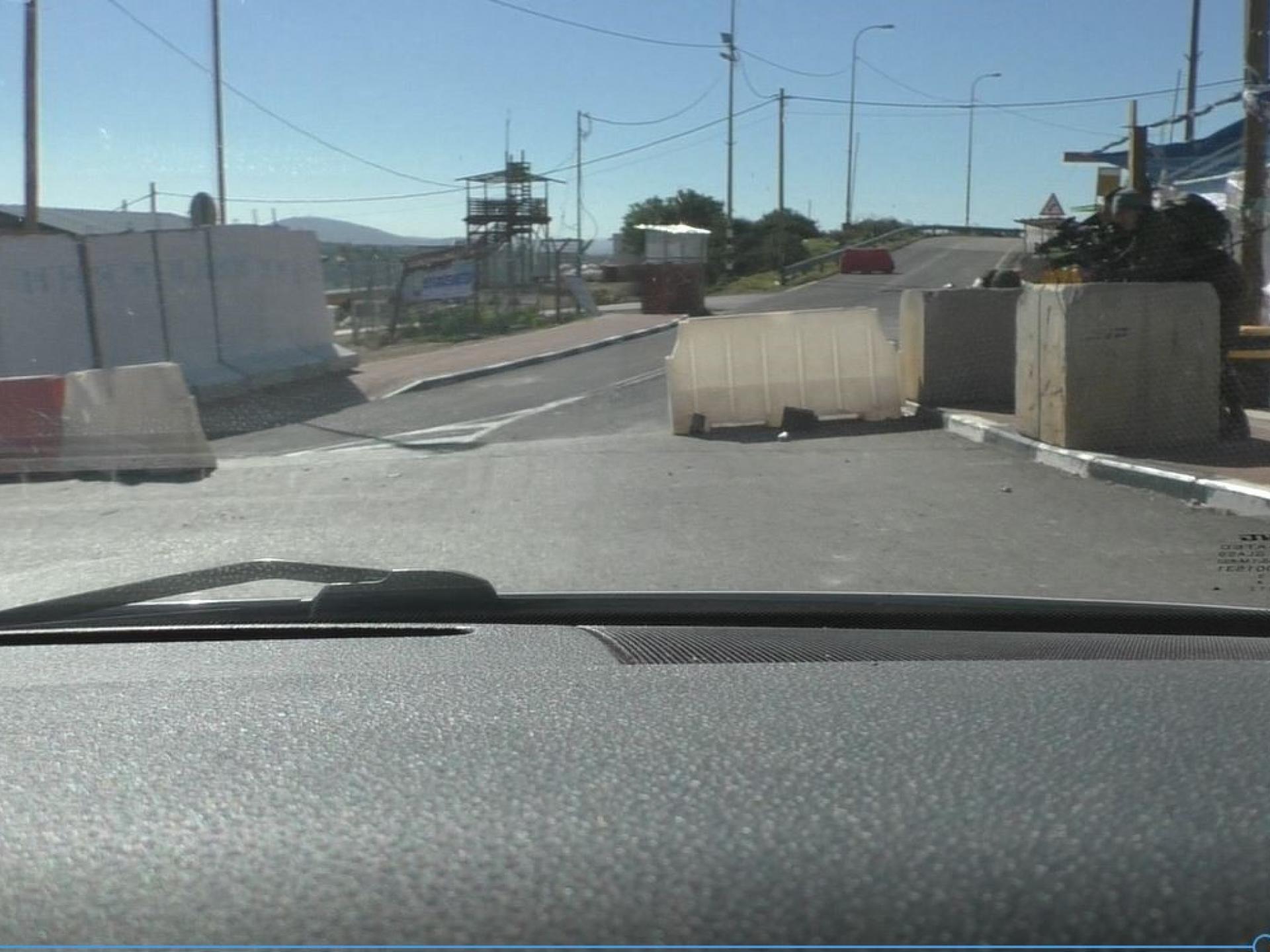
Highway 450 continues to the Talmonim bloc settlements. Olive groves along the road belong to residents of Beitilelu. A checkpoint with a yellow gate blocks the entrance to the Nahliel settlement, the first of the bloc when you arrive from this direction. A plastic barrier and additional gate to the settlement are located beyond the yellow barrier. The settlement’s barrier opens for us, the privileged whose car bears Israeli license plates.
From here to the junction of the Dolev-Talmon settlements, entry to Palestinians is blocked. A broad region, lovely, filled with springs, ancient trees and antiquity sites was taken from the Palestinian inhabitants when the settlements were established in the 1980’s.
Visit to two maqams trapped in the Talmonim bloc
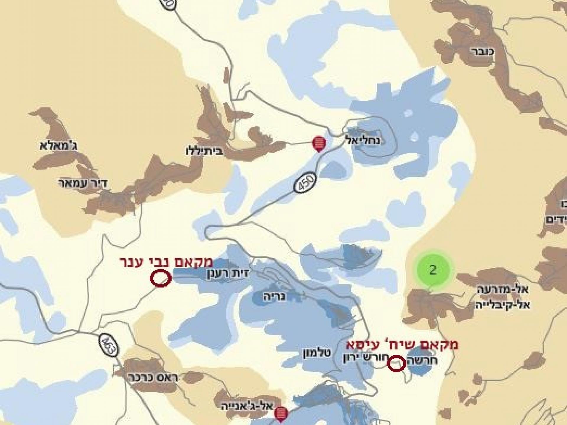
Maqam Sheikh Isa is located in the center of the Talmonim bloc, in an archaeological site where a system of underground wine presses and storerooms has been preserved, dating from the Iron Age (according to Wikipedia) and the Roman period (the period of the first and second temple). The site, controlled by the settlers, is called Giv’at Ha’yekevim. Signs with audio speakers provide information about the Jewish history of the site. Trees of various kinds grow there, most notably ancient olive trees.
The maqam itself is in ruins, but that didn’t prevent residents of Mazra’a al Qabaliya (which is about one kilometer away) to come for prayer and recreation in the natural setting. An interview in which the head of the village recalls his memories was filmed a week later.
Maqqam Nabi Anar is located next to the Zayit Ra’anan outpost, near Deir Amar village which neighbors the villages of Beitilelu and Ras a Karkar. The land around the maqqam belongs to residents of those villages. The site has remains of an ancient town, an ancient structure and a maqqam, old trees and a system of springs. The site was expropriated by the settlers of Neria outpost.
Last year Emeq Shaveh went to the Supreme Court to remove the invasion and the illegal construction at the Nabi Anar archaeological site.
Yoni Mizrahi published an article on the takeover of the Nabi Anar archaeological site by the Talmon bloc settlers and its transformation into a recreational area.
Access to the Nabi Anar site from highway 450 is through the Neria settlement. One drives through the settlement, then continues for a while to the Zayit Ra’anan outpost, crosses it and continues until one sees from the road the maqqam emerging from the trees. The settlers, in their characteristically cynical manner, renamed the site from Nabi Anar to Gan Ha’na’arim.
Settlers were working at the site when we arrived. One, a resident of Itamar who was called “the artist,” leaned against a memorial. It turned out they decided to change the name to “Ha’na’ar,” which was more similar to Nabi Anar, the original name.
The artist from Itamar was protected by the Talmonim bloc’s security commander. When he saw us – five elderly women – he was amazed by what we knew about the site and that we dared move so comfortably in a “dangerous area filled with terrorists.” He mentioned that a week earlier there were confrontations at the site between Palestinians and settlers. We introduced ourselves as members of Machsom Watch. He agreed with us that the name given to the site wasn’t appropriate.