Elkana salient, ‘Azzun, Falamya north, Falamya south, Habla - a tour with 2 guests
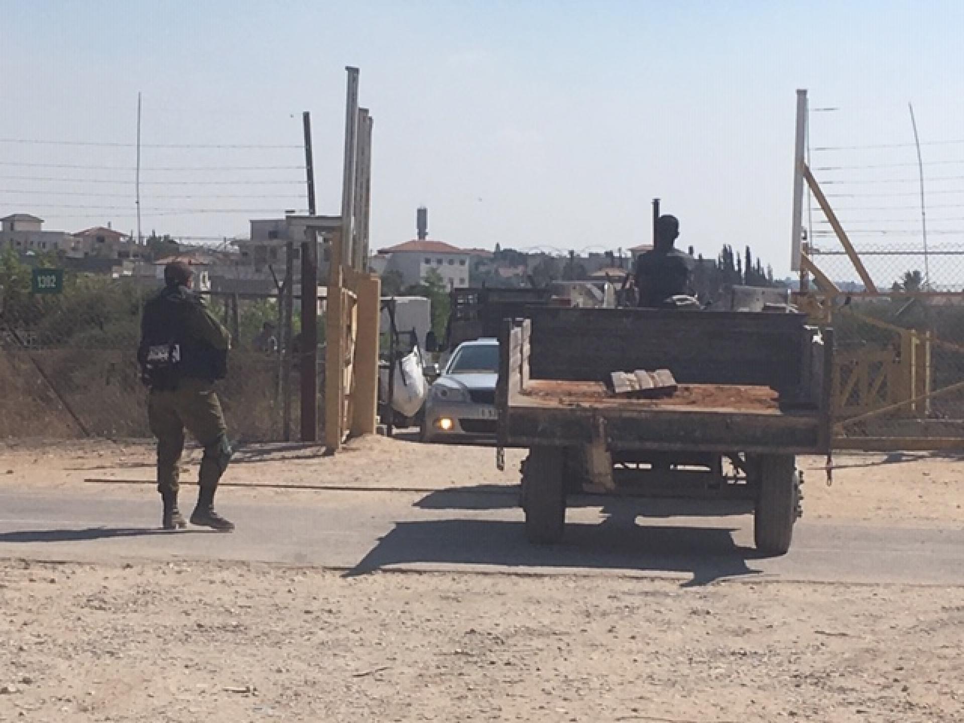
10:45 “Hani gate” checkpoint (1649). Large heaps of sand and building materials which weren’t here on a previous visit. A man emerges from a car that approaches rapidly and parks beside the gate, ignores us, and after a minute a second car arrives, four people emerge and all move toward the refuse heaps.
I continue explaining how the separation barrier wasn’t erected on the Green Line, and created the seam zone in order to allow access to the settlements established in this area and elsewhere along the border without going through checkpoints, allowing one to ignore the fact they were erected on Palestinian land.
While I’m explaining about Hani’s house, and using maps to show the direct route from Siniriyya to Miskha, which has been interrupted twice by the barrier, the men return to the cars. I ask what they’re planning. They reply: four or five more settlements between here and Siniriyya – ‘insh’allah…
We drive along the fearsome wall surrounding ‘Azzun Atma to Oranit checkpoint (1442), which the army has decided to keep closed as collective punishment for all of ‘Azzun Atma’s inhabitants who are cut off from their lands by the separation barrier. We spoke to some of them in the greenhouses near Kafr Qassem. They asked us to explain to the army that it’s difficult for them to travel a few kilometers north on foot or in a cart harnessed to a small donkey to the Abu Salman gate checkpoint (1419), and it’s hard for the donkey to pull the cart up and down the steep inclines of the wadi beyond the checkpoint – instead of being able to reach their village directly along the blocked road.
On the way to the checkpoints farther to the north I pointed out where the Green Line crossed Highway 55, and the great distance to the Eliyahu checkpoint because of the Alfei Menashe settlement. I also indicated Bedouin villages that remained on this side of the fence even after it had been moved following the Supreme Court decision that returned four villages to the Palestinian side. We stopped for a few minutes in ‘Azzun, which seemed quiet, and continued via Jayous and Kafr Jamal.
12:30 Falamya checkpoint (914). We spoke with two Palestinians who own land beyond the fence. They said they’d had no difficulty obtaining permits valid for two years, that the gates open as scheduled, and in fact a few minutes later the soldiers arrived and opened them. Most traffic was heading east, toward home – some people on foot or riding bicycles, 5-6 tractors, most pulling carts on which people were riding, but no produce. They said the olive harvest began officially on October 1, but the Palestinian Authority instructed not to begin before October 10 to allow additional ripening.
We continued to Falamya south/Jayous north checkpoint (935), explaining about the fence that that been moved and the flourishing agriculture which developed as soon as access to the lands didn’t depend on the checkpoints. Only one tractor waited beyond the fence. We returned via Jayous and ‘Azzun. A military vehicle already waited left of the exit to Highway 55.
13:45 Habla checkpoint (1393). Heavy traffic of cars, mostly toward the plant nurseries. The soldiers (MP’s) inspect the cars energetically, opening doors and trunks. A small truck also exited with crates of seedlings (a one-time event, or policy change?). Petahya and Tziona arrive and we drive for a brief visit with A. The repeated crossing of checkpoints to get from his home in Qalqilya to his lands and the plant nursery is exhausting.